
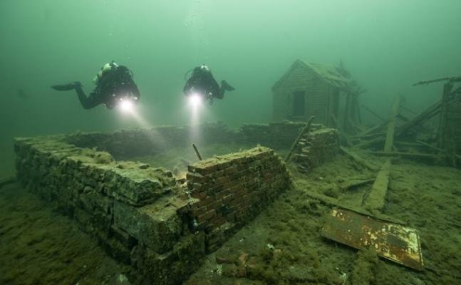
The phrase quabbin reservoir underwater pictures attracts thousands of curious readers because it combines history, mystery, and one of Massachusetts’ most important water resources. Many people have heard stories about entire towns resting beneath the reservoir and wonder whether photographs exist that show what remains underwater. Others hope to see submerged roads, building foundations, bridges, or even intact homes beneath the surface.
The reality is both fascinating and more complex than many online stories suggest. Quabbin Reservoir was created during the 1930s by flooding the Swift River Valley to provide a dependable drinking water supply for metropolitan Boston. Before the valley was flooded, nearly all buildings were removed, cemeteries were relocated, and infrastructure was carefully dismantled. As a result, genuine underwater photographs rarely show standing buildings, despite what some viral images on social media claim.
This article explains what authentic quabbin reservoir underwater pictures can and cannot reveal. It also examines the history behind the reservoir, why underwater photography is uncommon, what still exists beneath the water, and where to find reliable historical photographs and official information. By separating documented.
Read More: Best Fashion Magazines Subscriptions for Every Style (2026)
What Is Quabbin Reservoir?
Quabbin Reservoir is the largest inland body of fresh water in Massachusetts and serves as one of the primary drinking water sources for millions of residents in the Greater Boston area. Located in central Massachusetts, the reservoir spans portions of Worcester, Hampshire, Franklin, and Franklin County communities, surrounded by thousands of acres of protected forestland.
The reservoir was created by constructing the Winsor Dam and Goodnough Dike across the Swift River Valley. Filling began in the late 1930s, permanently transforming a rural landscape of farms, villages, forests, and roads into the expansive reservoir seen today.
Beyond supplying drinking water, Quabbin Reservoir has become an important wildlife habitat. Bald eagles, black bears, white-tailed deer, loons, beavers, and numerous fish species thrive in the protected watershed, making the area valuable for both conservation and recreation.
Where Is Quabbin Reservoir Located?
Quabbin Reservoir lies in central Massachusetts, approximately 65 miles (105 kilometers) west of Boston. The protected watershed covers more than 100,000 acres, with the reservoir itself extending across roughly 39 square miles.
The surrounding landscape consists of heavily forested hills, wetlands, streams, and managed conservation land. Public access is carefully controlled to protect water quality while still allowing activities such as hiking, fishing, birdwatching, cycling on designated roads, and seasonal boating under strict regulations.
Why Was Quabbin Reservoir Built?
During the late nineteenth and early twentieth centuries, Boston’s rapidly growing population placed increasing pressure on existing water supplies. Officials recognized that future demand would eventually exceed the capacity of available reservoirs.After years of engineering studies, state planners selected the Swift River Valley because it offered several advantages:
- Reliable river flow
- Large drainage basin
- Suitable topography for dam construction
- High-quality freshwater resources
The decision required enormous sacrifice. Thousands of residents were forced to relocate as four incorporated towns disappeared from the map. Although controversial, the project was considered essential for ensuring a long-term drinking water supply for eastern Massachusetts.Today, Quabbin Reservoir remains a cornerstone of the Massachusetts public water system and is carefully managed by state agencies responsible for watershed protection.
How Large Is the Reservoir?
Quabbin Reservoir is impressive by almost every measure.
| Feature | Description |
| Location | Central Massachusetts |
| Surface Area | Approximately 39 square miles (99 square kilometers) |
| Maximum Depth | About 150 feet (46 meters) |
| Storage Capacity | Nearly 412 billion gallons |
| Primary Purpose | Public drinking water supply |
| Water Source | Swift River and surrounding watershed |
Why Do People Search for Quabbin Reservoir Underwater Pictures?
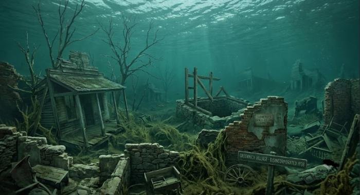
Interest in quabbin reservoir underwater pictures comes from several different audiences. Some are fascinated by abandoned places, while others are researching family history, photography, or Massachusetts history.
Curiosity About the Flooded Towns
Perhaps the biggest reason people search for underwater images is the story of the four towns that disappeared beneath the reservoir.These towns were:
- Dana
- Enfield
- Greenwich
- Prescott
Before flooding began, these communities contained homes, schools, churches, businesses, farms, cemeteries, roads, and bridges. Families had lived there for generations before being required to relocate.Knowing that entire communities once occupied the valley naturally leads many people to wonder whether buildings still remain underwater.
Interest in Submerged Roads and Historic Landscapes
Old maps reveal an extensive transportation network that once crossed the Swift River Valley. Roads connected neighboring towns, while bridges carried traffic across rivers and streams.Some visitors hope underwater photographs will reveal these forgotten routes. In reality, remnants such as roadbeds, stone retaining walls, cellar holes, and bridge foundations may still exist beneath sediment and water, although they are rarely visible.
Photography Enthusiasts
Landscape photographers often visit Quabbin Reservoir because of its scenic overlooks, wildlife, forests, and changing seasonal colors.
Some photographers are especially interested in documenting the historical transformation of the valley by comparing archival photographs taken before flooding with present-day views from similar locations.
Historical and Genealogical Research
Descendants of former residents frequently search for photographs connected to their ancestors.
Instead of underwater photography, they usually seek:
- Historic family homes
- School buildings
- Churches
- Town centers
- Cemeteries before relocation
- Maps of former neighborhoods
Many of these records survive in state archives, university collections, historical societies, and local museums.
Are There Real Quabbin Reservoir Underwater Pictures?
The short answer is yes but authentic underwater photographs are much less dramatic than many people expect.Images circulating online sometimes claim to show perfectly preserved churches, houses, or entire streets beneath Quabbin Reservoir. Most of these images are either unrelated to Quabbin, digitally altered, or created using artificial intelligence.Documented evidence paints a different picture.
Why Authentic Underwater Photos Are Rare
Several factors make underwater photography extremely difficult.First, Quabbin Reservoir is a protected drinking water source. Public swimming and recreational scuba diving are prohibited to protect water quality.Second, access to many shoreline areas is restricted, limiting opportunities for underwater exploration.
Finally, visibility beneath the water is often poor because of suspended particles, natural sediment, algae, seasonal conditions, and depth.These conditions make obtaining clear underwater photographs challenging even for trained professionals.
Water Clarity Changes Throughout the Year
Although Quabbin is known for exceptionally clean drinking water, underwater visibility varies significantly.Several natural factors affect visibility:
- Seasonal algae growth
- Sediment movement
- Water depth
- Wind conditions
- Organic matter
- Sunlight penetration
Surface water may appear crystal clear from shore, while visibility several meters below can decrease rapidly.
Safety and Environmental Regulations
Strict regulations exist because Quabbin Reservoir provides drinking water for millions of people.Visitors may enjoy approved recreational activities, but activities that could threaten water quality are carefully restricted.Examples include:
- Swimming
- Recreational scuba diving
- Unauthorized boating
- Entering protected watershed areas
These rules greatly limit opportunities for obtaining underwater photographs.
Historical Images Versus Underwater Photography
When people search for quabbin reservoir underwater pictures, they often actually want historical evidence showing what existed before flooding.Fortunately, there are thousands of documented photographs taken before construction of the reservoir.These include:
- Main streets
- Family farms
- Schools
- Churches
- Railroad stations
- Bridges
- Local businesses
- Town halls
- Construction of Winsor Dam
- Flooding of the Swift River Valley
These historical photographs often provide a much clearer understanding of the lost communities than modern underwater images ever could.
What Lies Beneath Quabbin Reservoir?
The question of what remains beneath Quabbin Reservoir has fascinated historians for decades.The answer depends largely on what was intentionally removed before flooding and what naturally survived afterward.
The Four Lost Towns: Four incorporated Massachusetts towns were officially disincorporated to make way for the reservoir.
Dana: Dana occupied the northeastern portion of the Swift River Valley. Residents relied on farming, local businesses, and small industries. Before flooding, buildings were removed and families relocated.
Enfield: Enfield was the largest of the four towns and served as an important commercial center. It contained churches, schools, shops, and residential neighborhoods. Historic photographs preserve much of its appearance before demolition.
Greenwich: Greenwich included productive farmland and several villages connected by country roads. Like the other towns, nearly all structures were dismantled before the reservoir filled.
Prescott: Prescott occupied higher elevations than the other communities. Portions of the town remained above the future waterline, but many residents still lost homes and farmland because of watershed protection requirements.
Roads, Bridges, and Stone Foundations
Although most buildings were demolished, not everything disappeared.Historical research indicates that features still beneath the reservoir may include:
- Stone cellar foundations
- Old roadbeds
- Bridge abutments
- Retaining walls
- Fieldstone fences
- Drainage structures
- Portions of utility infrastructure
Over decades, these features have become covered by layers of sediment, aquatic vegetation, and natural deposits, making them difficult to identify even with specialized equipment.
Cemeteries Were Carefully Relocated
One common misconception is that cemeteries remain beneath the reservoir.In reality, state authorities relocated thousands of graves before flooding began. Families were given opportunities to choose new burial locations, and many cemeteries were respectfully moved to higher ground.Today, relocated cemeteries continue to preserve the memory of the communities that once occupied the Swift River Valley.
Buildings Were Removed Before Flooding
Perhaps the biggest surprise for many readers is that most homes, schools, churches, mills, and commercial buildings were intentionally demolished before the valley filled with water.
Officials wanted to reduce floating debris, protect water quality, and avoid hazards within the future reservoir. Salvage crews removed reusable materials, while many structures were dismantled down to their foundations.
This explains why authentic quabbin reservoir underwater pictures rarely show intact buildings. Instead, any remaining underwater features are generally limited to foundations, stonework, buried infrastructure, and landscape features that have survived beneath decades of sediment and water.
Was Everything Left Underwater?
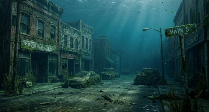
A common belief is that Quabbin Reservoir covered entire towns exactly as they stood, leaving houses, churches, schools, and businesses perfectly preserved beneath the water. Historical records from the Massachusetts Department of Conservation and Recreation (DCR), the Massachusetts Water Resources Authority (MWRA), and contemporary newspapers show a different story.
Before the reservoir began filling, the Commonwealth carried out one of the largest demolition and relocation projects in New England. Workers removed buildings, bridges, railroad tracks, utility lines, and many other structures. Valuable construction materials were salvaged, while unsafe buildings were dismantled.
Structures Demolished Before Filling
Most permanent structures were intentionally removed, including:
- Private homes
- Churches
- Schools
- Town halls
- Stores and businesses
- Mills and factories
- Railroad stations
- Utility buildings
This work reduced debris in the future reservoir and helped protect water quality.
Items Intentionally Removed
In addition to buildings, crews relocated or removed:
- Gravestones and human remains from cemeteries
- Telephone and electric infrastructure
- Railroad tracks
- Bridges where necessary
- Valuable building materials
Historical photographs taken during demolition document this massive undertaking and remain among the best visual records of the lost towns.
What Naturally Remains Beneath the Water
Although most buildings disappeared before flooding, several landscape features still exist beneath the reservoir:
- Stone walls marking former property lines
- Cellar holes
- Old roadbeds
- Bridge abutments
- Fieldstone foundations
- Portions of agricultural landscapes
After more than eighty years underwater, many of these features are buried beneath layers of sediment and are difficult to distinguish.
Can You See Anything Underwater Today?
The answer depends on water levels and location.During unusually dry years, when reservoir levels temporarily decline, visitors have occasionally observed remnants of old roads, stone walls, and foundations near exposed shorelines. However, these appearances are temporary and often occur only in restricted areas that remain inaccessible to the public.
Visible During Low Water Levels: Extended droughts can expose:
- Stone foundations
- Old road surfaces
- Field walls
- Tree stumps from the original valley
These features provide a rare glimpse into the landscape that existed before the reservoir.
Why Most Structures Cannot Be Seen: Several factors limit visibility:
- Decades of sediment accumulation
- Aquatic vegetation
- Water depth
- Restricted public access
- Natural erosion
As a result, authentic quabbin reservoir underwater pictures showing recognizable historic structures are exceptionally uncommon.
Why Is Underwater Photography So Limited?
Many visitors assume photographers simply need permission to dive into the reservoir. In reality, protecting the drinking water supply is the highest priority.
Drinking Water Protection
Quabbin Reservoir supplies high-quality drinking water to millions of Massachusetts residents. Protecting water quality requires strict management of recreational activities.Swimming and recreational scuba diving are prohibited because they could introduce contaminants or disturb sensitive environments.
Restricted Access
Only designated roads, trails, fishing areas, and approved boating locations are open to the public. Large portions of the watershed remain closed to minimize environmental impacts.
Environmental Conservation
The surrounding forests naturally filter rainfall before it reaches the reservoir. This protected watershed is a major reason Quabbin’s water requires relatively limited treatment compared with many public water systems.Conservation efforts also support wildlife, including:
- Bald eagles
- Common loons
- River otters
- Black bears
- White-tailed deer
- Wild turkeys
- Beavers
Where Can You Find Authentic Quabbin Reservoir Underwater Pictures?
Although genuine underwater photographs are limited, many reliable resources document the reservoir’s history.Some of the best sources include:
- Massachusetts Department of Conservation and Recreation (DCR)
- Massachusetts Water Resources Authority (MWRA)
- Massachusetts State Archives
- University of Massachusetts Libraries
- Boston Public Library Digital Collections
- Library of Congress
- Local historical societies in former Swift River Valley communities
These collections contain thousands of historical images taken before demolition, during construction, and while the valley was gradually flooded.
Common Myths About Quabbin Reservoir Underwater Pictures
The popularity of abandoned places has encouraged many misleading claims online. Understanding the facts helps separate genuine history from internet myths.
Myth: Entire Houses Still Stand Underwater
Historical documentation indicates that nearly all homes were demolished before flooding.While foundations may remain, complete houses standing underwater are not supported by official records.
Myth: Churches Are Perfectly Preserved
Churches were dismantled before the reservoir filled.Many viral images claiming to show submerged churches actually come from unrelated reservoirs around the world or are digitally altered.
Myth: Viral Social Media Photos Show Quabbin Reservoir
Reverse-image searches frequently reveal that popular underwater photographs originate elsewhere.Some images are created using computer graphics or artificial intelligence rather than authentic photography.Always verify photographs through reputable archives or official organizations before accepting them as genuine.
Can You Visit Quabbin Reservoir?
Yes. Quabbin Reservoir welcomes visitors throughout much of the year, although recreation is carefully managed.Popular activities include:
- Hiking
- Wildlife watching
- Scenic photography
- Fishing
- Seasonal boating by permit
- Cycling on designated roads
- Educational visits
Observation towers and scenic overlooks provide outstanding views across the reservoir and surrounding forests.Visitors should always follow posted regulations designed to protect both wildlife and drinking water quality.
Wildlife Around Quabbin Reservoir
Although many people focus on the lost towns, Quabbin has also become one of Massachusetts’ most important wildlife habitats.Protected forests surrounding the reservoir support remarkable biodiversity.Some commonly observed species include:
- Bald eagles
- Ospreys
- Common loons
- Black bears
- Coyotes
- White-tailed deer
- Beavers
- River otters
- Wild turkeys
- Numerous migratory birds
The healthy ecosystem demonstrates how careful watershed management can benefit both people and wildlife.
Historical Timeline of Quabbin Reservoir
Understanding the reservoir’s history helps explain why quabbin reservoir underwater pictures continue to attract public interest.
- 1890s–1920s: Engineers study future water needs for metropolitan Boston.
- 1927: Massachusetts approves creation of the Quabbin Reservoir project.
- Late 1920s–1930s: Land acquisition begins, and residents gradually relocate.
- 1930s: Buildings are demolished, cemeteries relocated, and infrastructure removed.
- 1935–1939: Winsor Dam and Goodnough Dike are completed.
- 1939: Reservoir begins filling.
- 1946: Water from Quabbin enters the metropolitan Boston water supply.
- Present Day: Quabbin remains a protected drinking water source and major conservation area.
Interesting Facts About Quabbin Reservoir
- It is the largest inland freshwater body in Massachusetts.
- It stores nearly 412 billion gallons of water.
- Millions of people depend on it for drinking water.
- More than 100,000 acres of protected watershed surround the reservoir.
- The area has become one of New England’s premier locations for birdwatching and wildlife conservation.
- Bald eagles, once rare in Massachusetts, now nest successfully within the Quabbin watershed.
- The reservoir’s protected forests naturally help maintain exceptional water quality.
Conclusion
Interest in quabbin reservoir underwater pictures reflects a broader fascination with the history of the Swift River Valley and the communities that made way for one of Massachusetts’ most significant public works projects. While popular myths often suggest that entire towns remain perfectly preserved beneath the water, historical evidence tells a more accurate story. Before the reservoir filled, most homes, churches, schools, and public buildings were carefully demolished, and cemeteries were respectfully relocated.
Today, what remains beneath the surface is largely limited to stone foundations, old roadbeds, field walls, bridge remnants, and other landscape features that have been covered by decades of sediment. Because Quabbin Reservoir is a protected drinking water source, strict regulations also make underwater photography and diving extremely uncommon.
For anyone interested in the reservoir’s hidden past, the most reliable resources are official archives, government agencies, university collections, and historical societies. Their photographs, maps, and records provide a well-documented account of the lost towns and the creation of Quabbin Reservoir—offering a far more accurate and meaningful perspective than the many unverified images circulating online.
Frequently Asked Questions
Q1. Are there real quabbin reservoir underwater pictures?
Ans: Yes, but authentic underwater photographs are relatively rare because scuba diving is prohibited, visibility is limited, and public access is restricted. Most reliable historical images show the towns before flooding rather than underwater scenes.
Q2. What towns are beneath Quabbin Reservoir?
Ans: The reservoir flooded the former Massachusetts towns of Dana, Enfield, Greenwich, and Prescott after residents were relocated and most structures were removed.
Q3. Are buildings still standing underwater?
Ans: Official historical records indicate that nearly all buildings were demolished before flooding. Some foundations, stone walls, and roadbeds may still remain beneath the reservoir.
Q4. Can visitors scuba dive in Quabbin Reservoir?
Ans: No. Recreational scuba diving is prohibited to protect the public drinking water supply.
Q5. Is swimming allowed in Quabbin Reservoir?
Ans: No. Swimming is not permitted because maintaining water quality is the reservoir’s highest priority.
Q6. Where can I find authentic historical photographs?
Ans: Reliable photographs are available through the Massachusetts DCR, MWRA, Library of Congress, university archives, historical societies, and other official digital collections.
Q7. Why are so many online underwater photos misleading?
Ans: Many widely shared images come from different reservoirs, are digitally edited, or are AI-generated. Always verify their source before assuming they depict Quabbin Reservoir.
